Hurricane Paulette rolls toward Bermuda as Sally approaches US
Paulette expected to bring storm surge, coastal floods and high winds to Bermuda; Storm Sally approaches US Gulf Coast.
Published On 13 Sep 2020
Residents of Bermuda were urged to prepare to protect life and property ahead of Hurricane Paulette, while Tropical Storm Sally threatened to intensify into a hurricane as it approached the United States’ Gulf Coast.
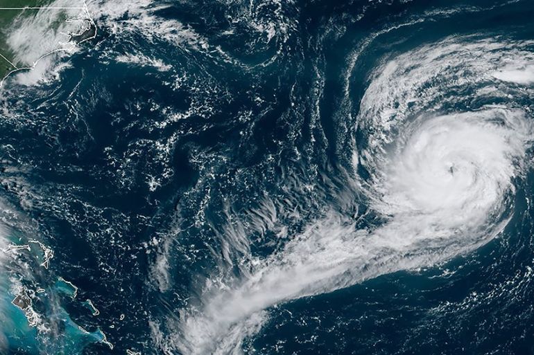
Paulette gained hurricane status late Saturday and was expected to bring storm surge, coastal flooding and high winds to Bermuda, according to a US National Hurricane Center advisory.
Keep reading
list of 4 itemsScientists say Oman, UAE deluge ‘most likely’ linked to climate change
Photos: Deadly floods wreak havoc in Kenya’s capital
China evacuates over 100,000 as heavy rain continues to lash south
Bermuda’s government announced that LF Wade International Airport would close Sunday evening, and government buildings would be closed on Monday and Tuesday. It opened several shelters for evacuees.
Paulette had maximum sustained winds of 130 km/h (80 mph) as the system moved along a curved course towards Bermuda, forecasters said. The biggest threats were strong winds, storm surge, up to 15cm (6 inches) of rain and life-threatening surf and rip currents.
The storm was 386km (240 miles) southeast of the territory Sunday and was moving northwest at 23 km/h (14mph). It is the strongest in terms of winds of six disturbances the centre was tracking in the Atlantic Ocean and Gulf of Mexico.
New Orleans and surrounding areas, meanwhile, were in the crosshairs of Sally, which was expected to become a hurricane on Monday and reach shore by early Tuesday – bringing hurricane conditions to a region stretching from Morgan City, Louisiana, to Ocean Springs, Mississippi. Tropical storm conditions were expected in the region by Monday.
Louisiana Governor John Bel Edwards declared a state of emergency Saturday, and officials in the New Orleans area issued a mandatory evacuation order for areas outside of levee protection.
The tropical storm had maximum sustained winds of 95km/h (60 mph) with higher gusts, forecasters said.
Storm surge from Sally was forecast to reach dangerous levels, due in part to the tide.
Up to 3.4m (11 feet) of water was predicted from the mouth of the Mississippi River to Ocean Springs, Mississippi, including Lake Borgne.
A slow-moving storm, Sally could produce rain totals up to 51cm (20 inches) by the middle of the week, forecasters said.
The system was moving west-northwest at 21km/h (13mph) early Sunday. It was centred 220km (135 miles) west of St Petersburg, Florida, and 450km (280 miles) east-southeast of the mouth of the Mississippi River. Heavy rain was battering the southwest coast of Florida, the Hurricane Center said in its 11am (15:00 GMT) advisory.
Once a tropical storm, Rene was forecast to become a remnant low cyclone on Monday. Tropical Depression Twenty was expected to strengthen this week and become a tropical storm by Tuesday, forecasters said.
A low-pressure system near the Cabo Verde Islands had a high chance of formation, while a disturbance in the Gulf had a low chance of formation. The Hurricane Center also reported a tropical depression in the central Atlantic that did not appear to threaten land.
Source: AP