Mapping the scale of damage by the catastrophic Pakistan floods
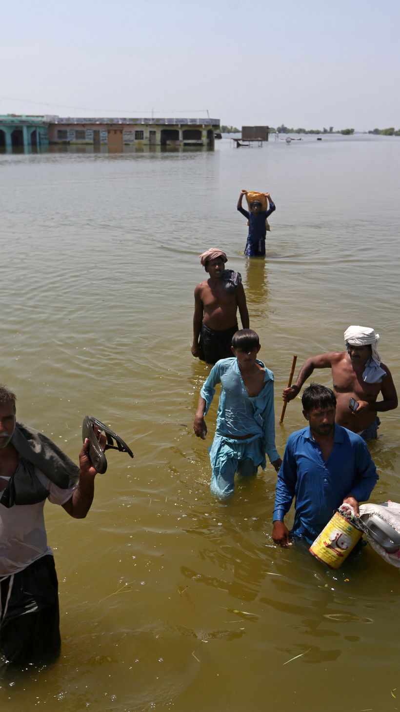
Weeks of torrential rains and flash floods have ravaged Pakistan.
The South Asian nation of some 220 million people is at the epicentre of a climate crisis following historic monsoon rains in July and August.
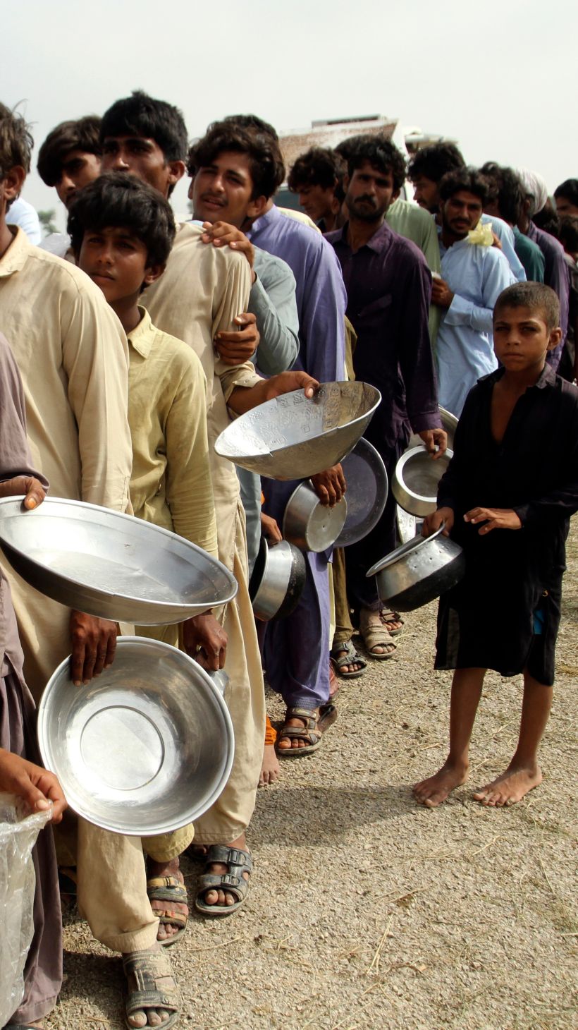
More than 1,500 people have died so far while 33 million people were affected.
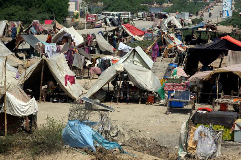
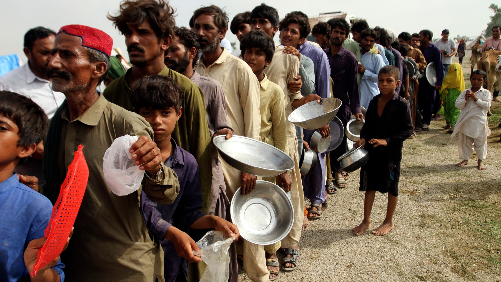
According to Pakistan’s National Disaster Management Authority, rescue and recovery missions are slow, and more than half a million people are still in makeshift camps.
![]()
Pakistan’s climate change minister, Sherry Rehman, called the extreme weather “the monster monsoon of the decade”.
The government estimates total financial losses at $30bn, with at least four million hectares (9.8 million acres) of diverse agricultural land destroyed, according to Ahsan Iqbal, the minister of planning for the government.
Both Pakistan and the United Nations have blamed climate change for the extreme weather and resulting devastation. UN Secretary-General Antonio Guterres described the level of rainfall as “epochal”.
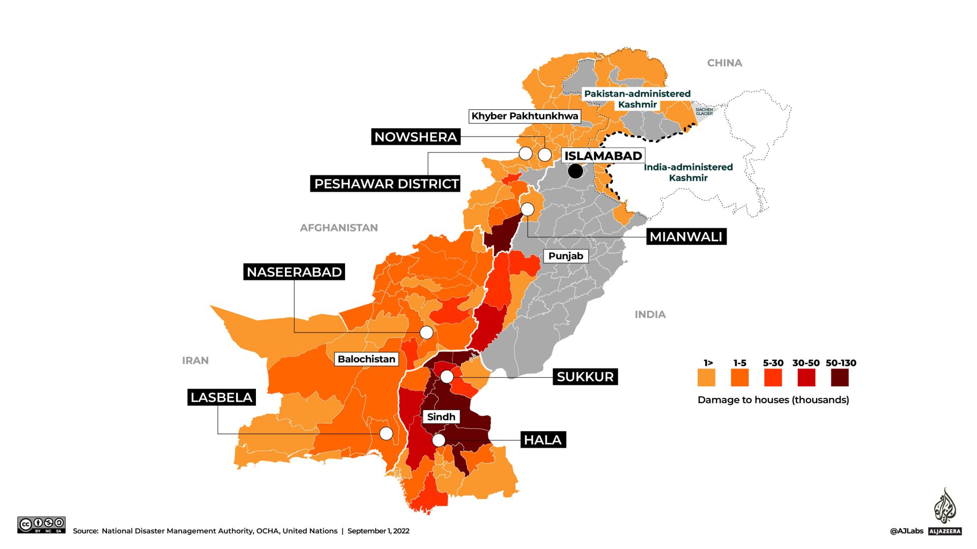
According to the National Disaster Management Authority, at least 81 of the country’s 160 districts have been categorised as “calamity hit” by the floods.
In the following series of visual features, Al Jazeera maps out the damage caused by the floods from the worst-affected regions of the south to the north: the loss of lives, property, livestock and inundation of crops.
Worst-affected regions
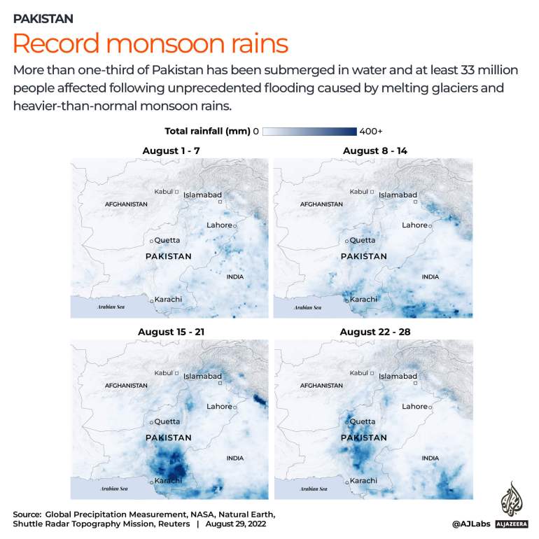
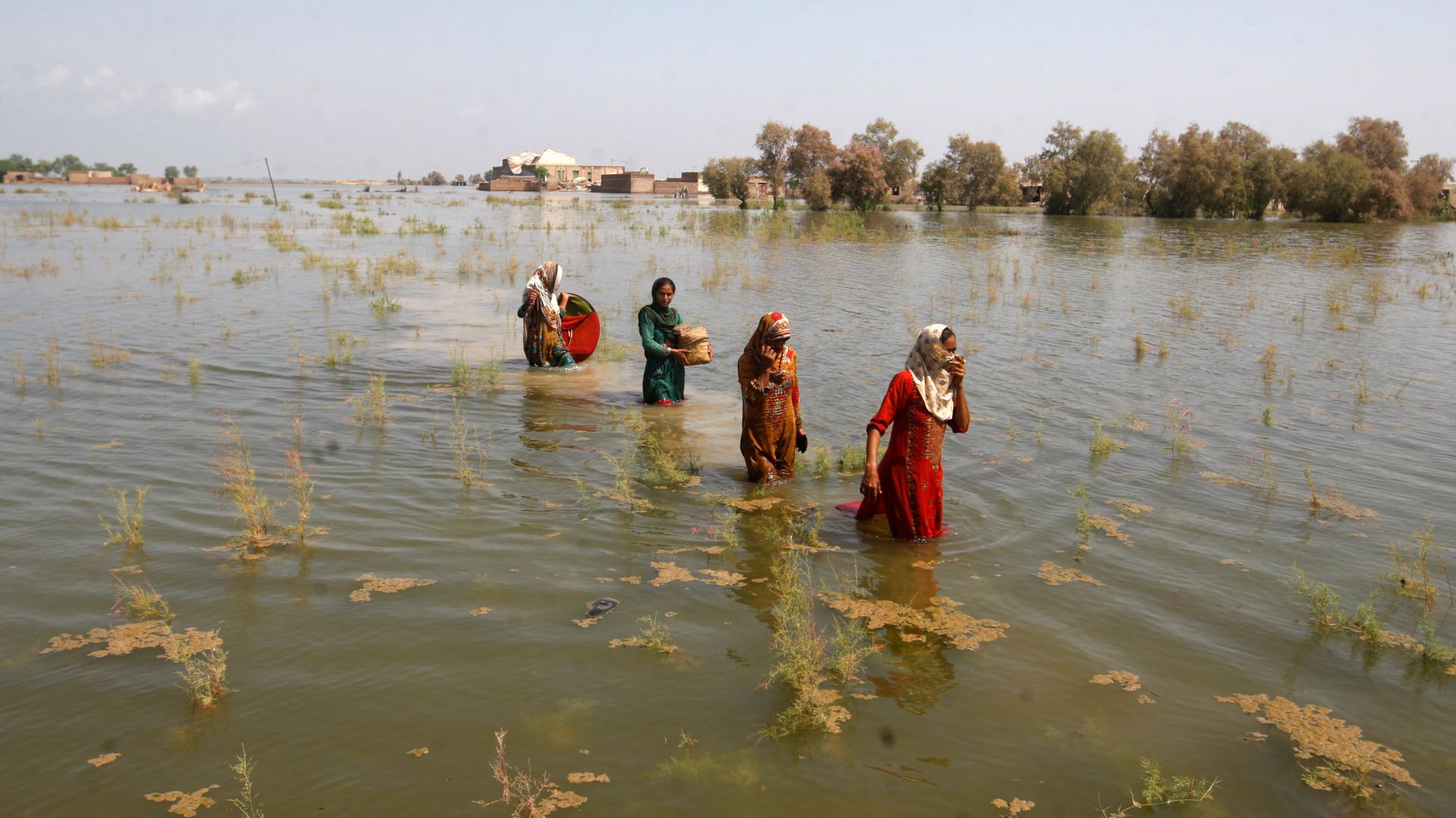
Pakistan’s southern provinces of Sindh and Balochistan have been the hardest hit by the recent floods. According to Pakistan’s Meteorological Department, August rainfall in Sindh was 726 percent higher than the monthly average and 590 percent in neighbouring Balochistan.
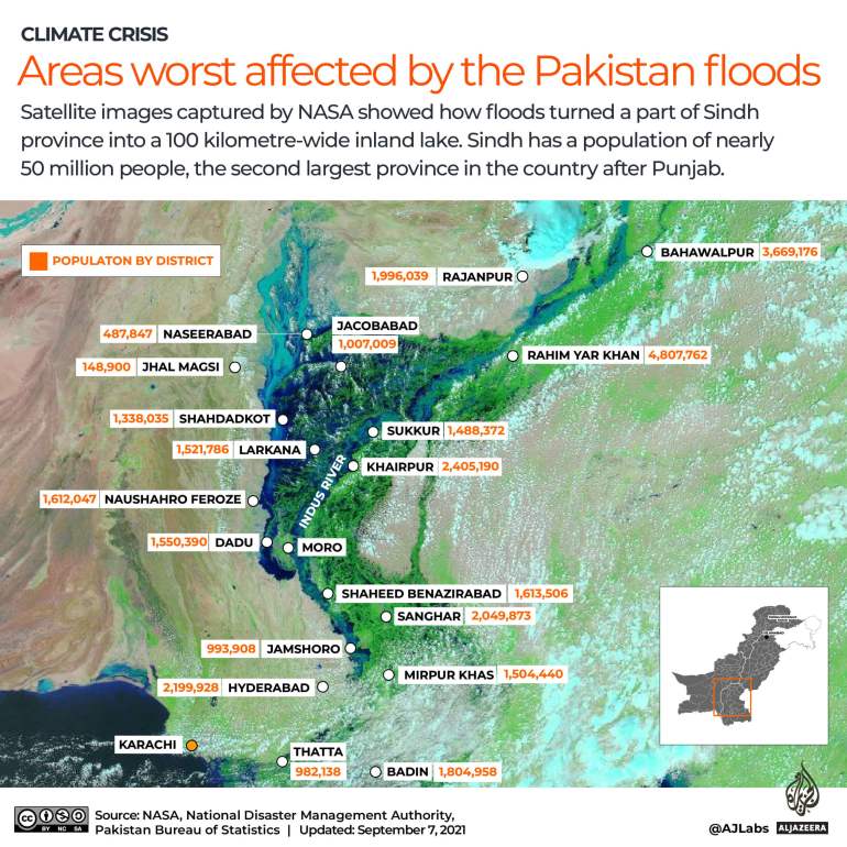
Satellite images by NASA showed that excessive rain flooded areas in Sindh province into a 100-kilometre-wide inland lake. Sindh has a population of nearly 50 million people, the second-largest province in the country after Punjab.
100km lake in Sindh
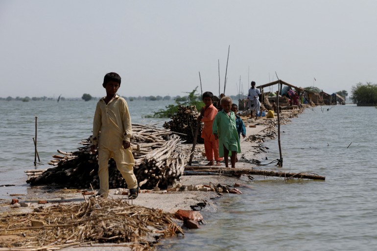
Sindh’s villages washed away
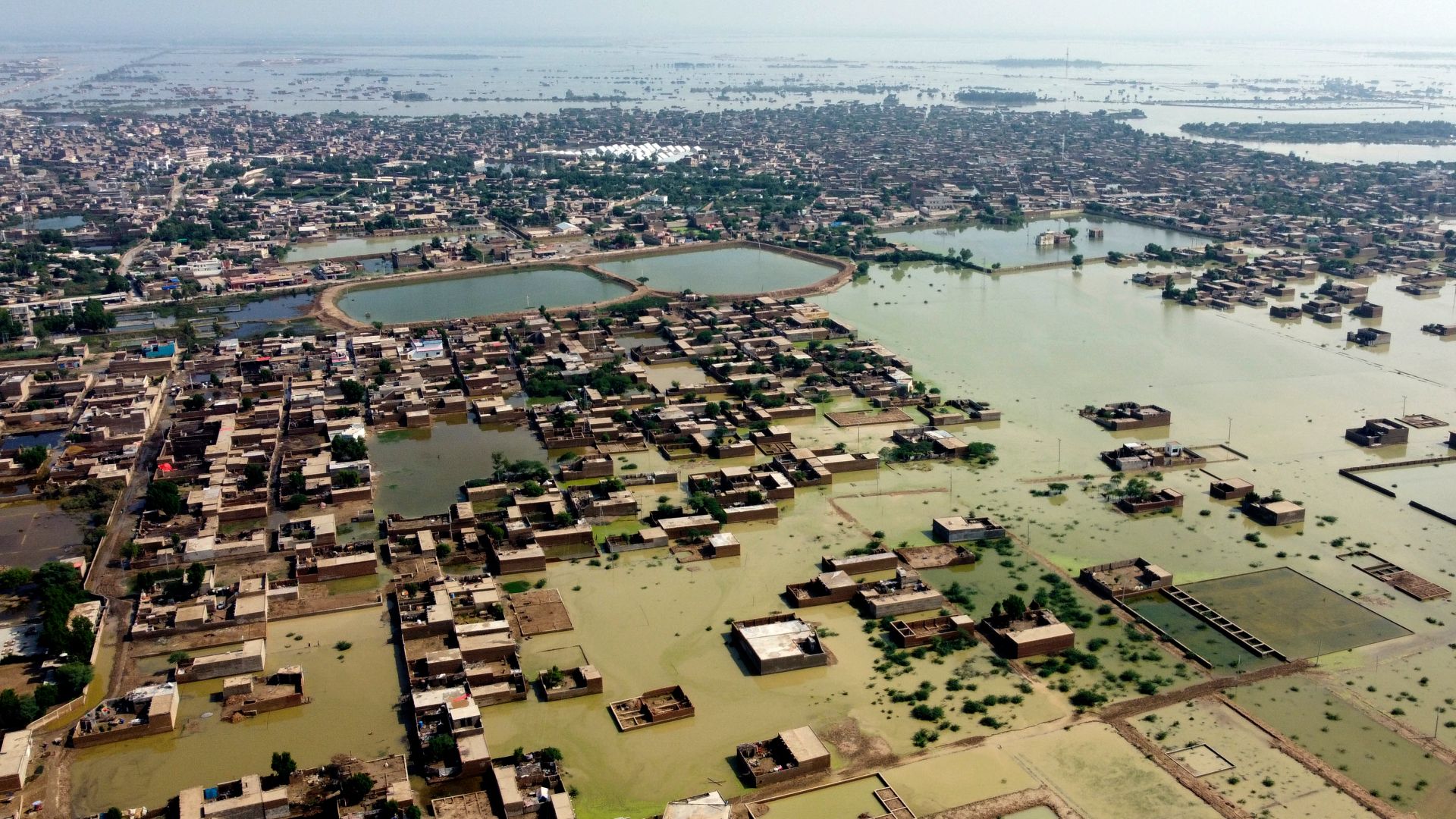
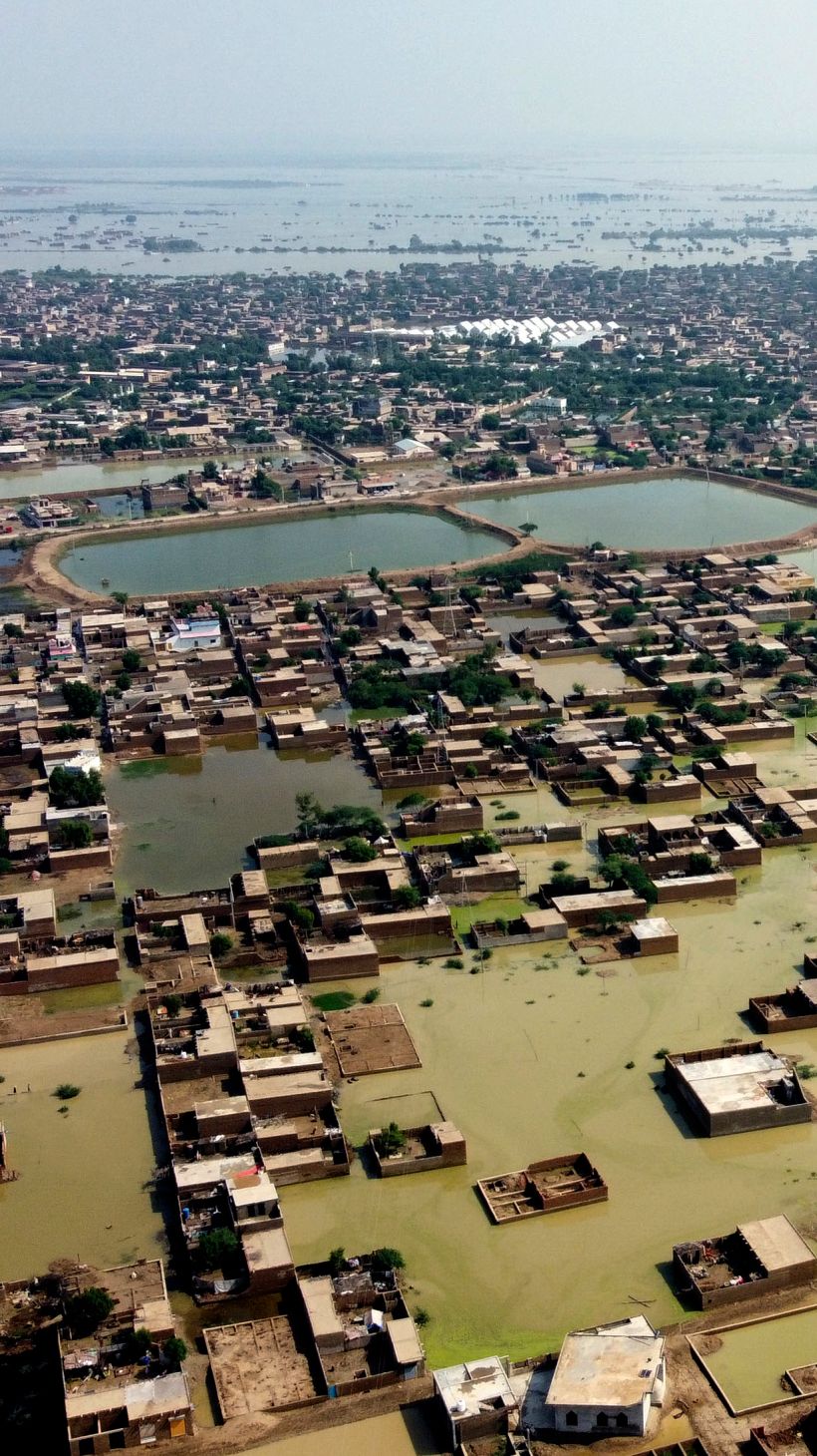
Before and after: Sukkur, Sindh
Ellahi Buksh, 34, is a daily wage worker who breaks stones in the impoverished Bahri Patni village in Sindh’s Rohri area that lies east of Sukkur town.
When the rains began washing away his mud house, he fled with his family and their belongings to the only asphalt road in the village.
“We have been sitting here for 15 days with no help. We have no money, no daily work, and no way to feed our families”, he told Al Jazeera, his voice quivering.
“The aid is going to people who don’t need it, and those are people who have political connections,” he alleged. “Nothing is being done to pump out water or help the dozens of women who are about to give birth. Scraps of food are shared amongst everyone sitting on the roadside, waiting for help.”
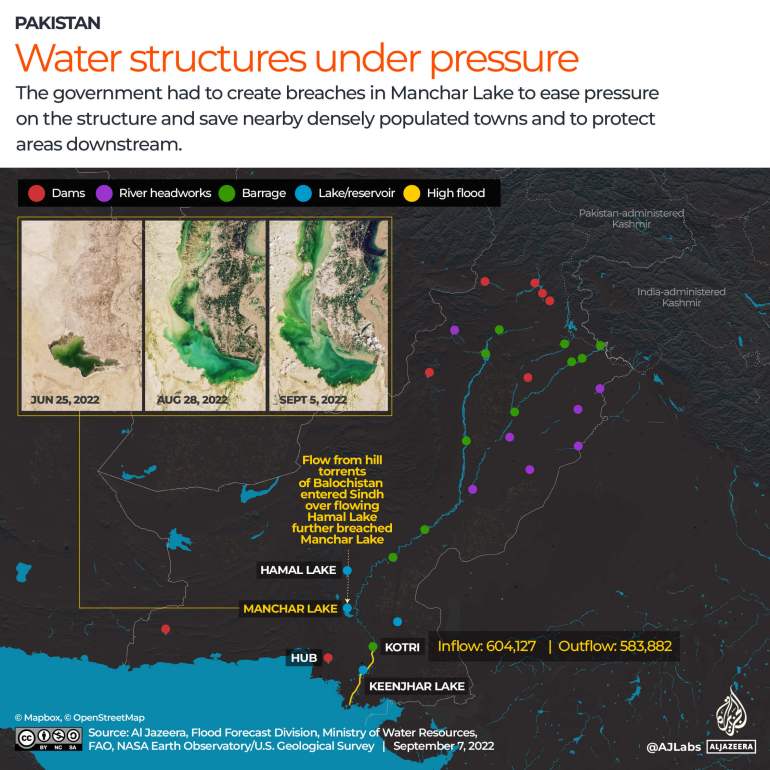
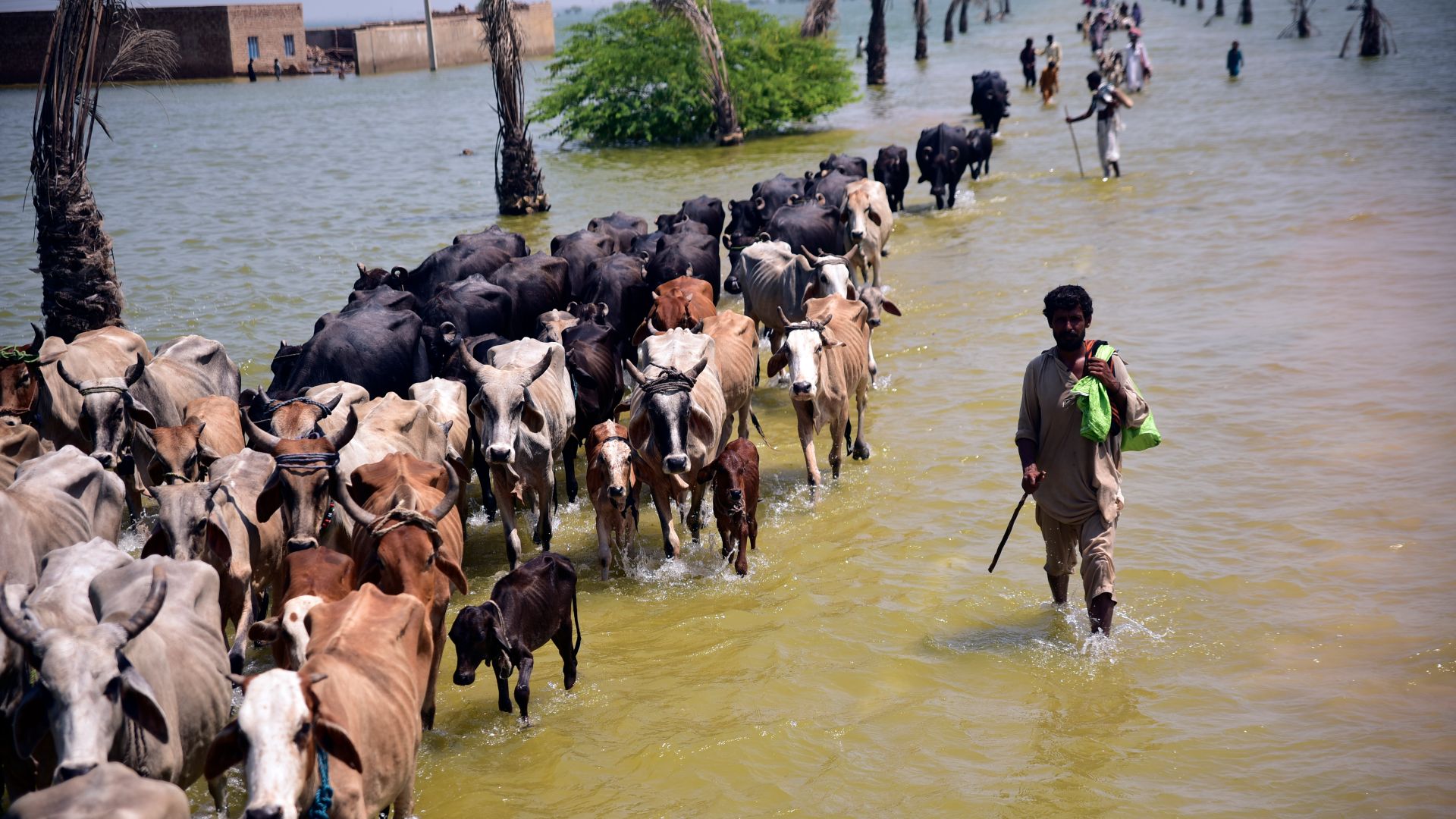
Manchar Lake breached
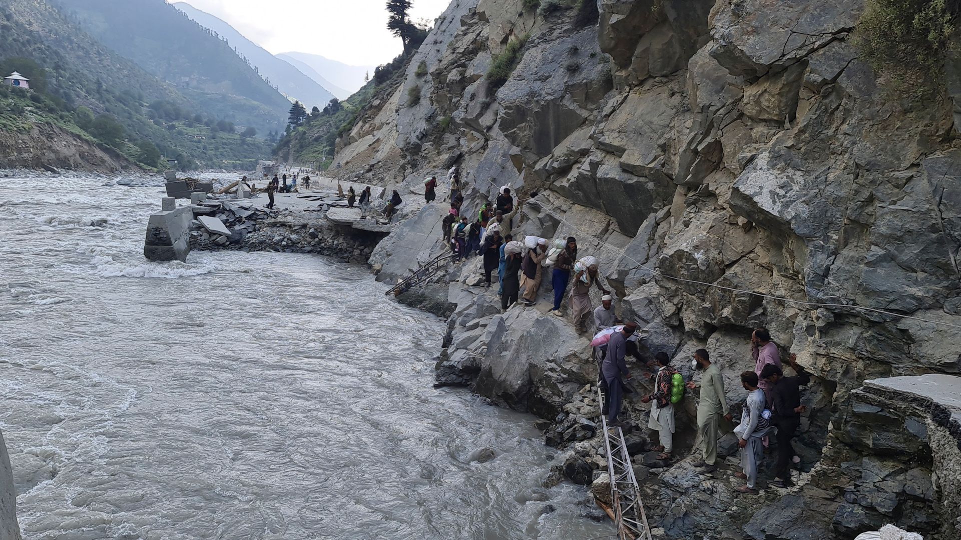
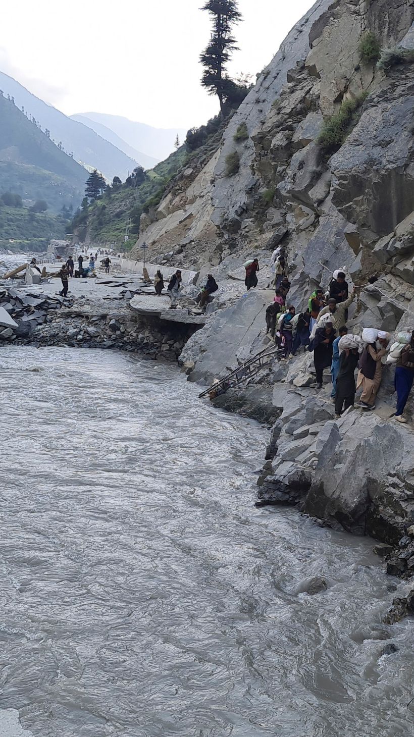
As the floodwater drains out from the hilly areas, it flows down hill torrents, a type of rainwater harvesting drainage from the mountains to agricultural lands. The water works its way down, adding to the overflow from the smaller tributaries to the lakes.
The floodwaters grew as mountainous ranges drained down to the plain fields.
The embankments of the country’s largest freshwater body, Manchar Lake, were broken multiple times by officials in the last weeks to avoid overflow and direct the water to the Indus river, about 5km (3.1 miles) from the lake.
Water levels remained alarmingly high despite the breach. Not directing the water into a particular area would have further damaged densely populated areas surrounding the lake.
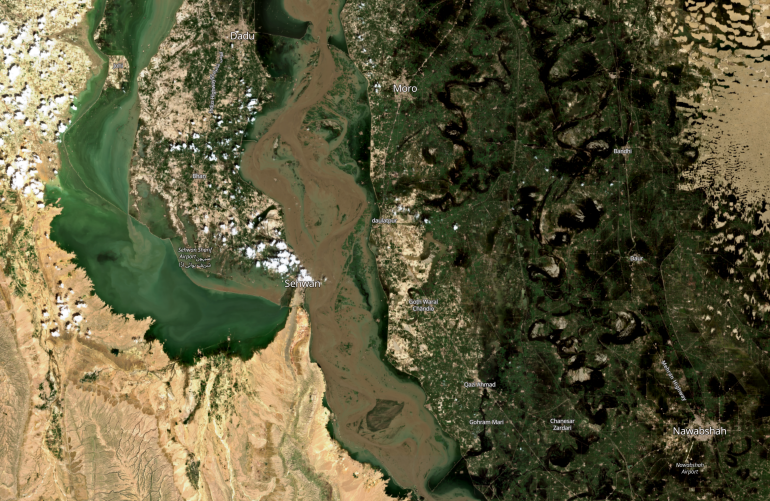
Almost 150,000 people were displaced in the efforts to keep the lake from overflowing.
Impoverished Balochistan
Lal Khatoon, 37, along with her seven children and ailing husband, has been living on the Quetta-Sukkur highway for the past month after floodwaters overran her house in Naseerabad, Balochistan.
“I was able to pick just two charpoys (rope beds) from the floodwater. The rest of my goods, including the food items including rice and wheat, were swept away. Now, I am living under the charpoys and covering them with blankets to beat the scorching sun,” Khatoon told Al Jazeera by telephone from Dera Allah Yar, a town about 60km (37 miles) north of Naseerabad.
“One of my daughters was hit by a vehicle when she was playing near the highway some days back. I took her to a government hospital, but they just provided me with medicines. Now, all of my children are sick, and I don’t have enough rations to feed them,” Khatoon said.
“The people sitting on the roadsides are fed by private charity organisers who come with food and goods, and the rest of the time, they sleep hungry. When Prime Minister Mian Muhammad Shehbaz Sharif was visiting nearby, the administration provided us with just one bottle of water, but after he left, no one came to ask what condition we were living in,” she added.
Khyber Pakhtunkhwa
Before and after: Nowshera, Khyber Pakhtunkhwa
In northern Pakistan, approximately 130km (80 miles) from capital Islamabad, lies Nowshera, a city of 120,000 people.
Mehwish Malik, 27, a resident of Nowshera, recently returned to her home with her husband and three children, aged five, two, and five months.
Two weeks ago, Malik and her family had to flee their home in the middle of the night when flash floods swept across the city. She says the local government forced them out of their homes, but they were not expecting the floods to be this destructive.
“My neighbours’ homes began getting water, and it hadn’t yet started in our house when we decided to run for it. But it was impossible, gathering a few small things and trying to get out as the water was rising with the children, the mud, and the traffic – it was horrific,” she told Al Jazeera.
“My house upon coming back is still filled with muck from the floodwater, my children have all sorts of skin issues, and from what we can see, the water was at least five feet (1.5 metres) in the rooms. We couldn’t take anything with us, and everything left behind is ruined,” she added.
Malik remembers the floods in 2010 that inundated her home. But this time, she said, they were told the river banks were strong.
The pressure of the flash floods that pummelled the surrounding areas broke the embankments of the Kabul River. The floods had already wiped out the bridge at Munda Headworks, making the area vulnerable to more flooding.
Water has receded in Nowshera, allowing people who had fled to return home.
Before and after: Kabul River, Khyber Pakhtunkhwa
Punjab
Although the level of destruction in Punjab province was not as severe as in other parts of the country, at least 191 people have been killed, and thousands of square kilometres of cropland swept away.
According to local media, the areas most affected in the province were the southern districts of Rajanpur, Taunsa, Dera Ghazi Khan, Eisa Khel, Jampur, as well as parts of Layyah.
Fazl-e-Rab, 47, is a farmer and landowner who also is a social and political worker from Taunsa, a city of 50,000 people, not far from the Indus river. He says the rains that began in June just kept getting stronger every day.
“The houses people were forced to abandon are filled with silt from the flash floods and filled up 10-15 feet (3-4.5 metres). Entire villages are buried under it; you can’t even tell there was a dwelling here,” he told Al Jazeera.
Before and after: Mianwali, Punjab
“Roads are destroyed, it’s hard for everyone to commute for daily wages and the irrigation system for the fields is entirely ruined. The amount of money people spent on the cotton and rice crops – the cultivation, seeds, diesel, pesticide, fertiliser – the cash crop is just gone. The height of the ground has changed; I don’t know how we will fix our fields in the coming years,” he said.
He says fixing the irrigation system is up to the provincial government, and he has little faith that fields will be helped and the watering system fixed for the farmers in the upcoming seasons.
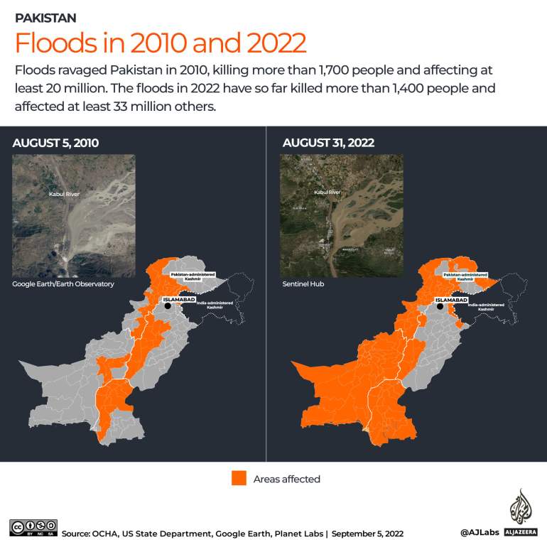
How the 2022 floods compare with 2010

In 2010, similar floods ravaged Pakistan, killing more than 1,700 people and affecting at least 20 million others, according to official data.
The 2010 floods were riverine, which occur when excessive rains cause rivers to overflow, usually at a slower rate.
This year’s floods have been categorised as flash floods, which are caused by intense storms that produce heavy rainfall in a short amount of time. These types of floods are more common in areas with a dry climate and rocky terrain where a lack of soil or vegetation allows torrential rains to flow overland rather than sink into the ground.
Additional reporting from Balochistan by Saadullah Akhter