Eta regains hurricane strength as Florida prepares for hit
The storm’s maximum sustained wind speed increased to about 120kmph (75mph) off Florida’s southwest coast.

Published On 11 Nov 2020
Eta regained hurricane strength on Wednesday morning as Florida braced for a second hit from the storm.
The storm’s maximum sustained wind speed increased to almost 120kmph (75mph) off Florida’s southwest coast.
Keep reading
list of 4 itemsPhotos: Deadly floods wreak havoc in Kenya’s capital
Dust storm turns sky orange over Athens
Photos: Athens turns orange under North Africa’s Sahara dust clouds
Forecasters at the National Hurricane Center in Miami issued a hurricane watch for a 193km (120 miles) stretch that includes Tampa and St Petersburg. The storm has been in the Gulf of Mexico since crossing over South Florida on Sunday.
The latest hurricane watch extends from Anna Maria Island, which is south of St Petersburg, to Yankeetown.
Eta was about 210km (130 miles) west-southwest of Fort Myers early on Wednesday and moving at 24kmph (15mph).
The hurricane centre said a “life-threatening storm surge” is possible early on Thursday, and forecasters advised residents to heed warnings from local officials. Tropical storm-force winds are expected in the area by late Wednesday.
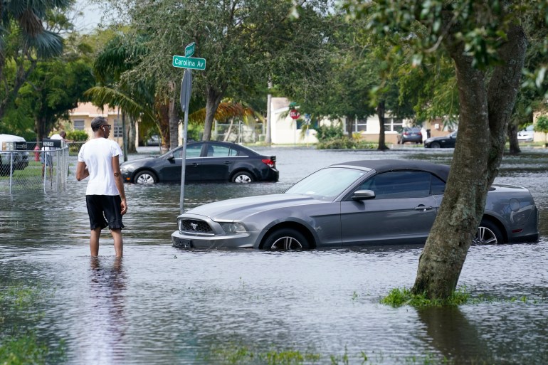
Forecasts call for more rain from the storm system over parts of already drenched South Florida.
“Never seen this, never, not this deep,” said Anthony Lyas, who has lived in his now-waterlogged Fort Lauderdale neighbourhood since 1996. He described hearing water and debris slamming against his shuttered home overnight as the storm crossed Florida.
The storm first hit Nicaragua as a Category 4 hurricane and killed nearly 70 people from Mexico to Panama, before moving into the Gulf of Mexico early on Monday near where the Everglades meet the sea, with maximum sustained winds of 85kmph (53mph).
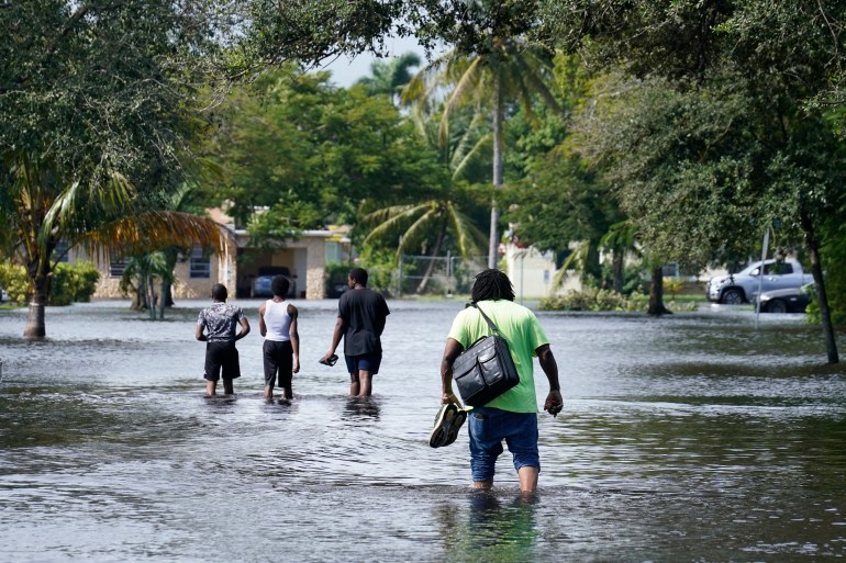
“It was far worse than we could’ve ever imagined, and we were prepared,” said Arbie Walker, a 27-year-old student whose Fort Lauderdale apartment was filled with about 150mm (6 inches) of water.
There was nowhere for the water to go across much of South Florida, which had already experienced nearly 350mm (14 inches) of rain in October.
As much as 400mm (16 inches) of rain damaged one of the state’s largest COVID-19 testing sites, at Miami-Dade County’s Hard Rock Stadium, officials said. Throughout the pandemic, it has been among the busiest places to get a coronavirus diagnosis. The site was expected to be closed until Wednesday or Thursday.
Eta hit land late on Sunday as it blew over Lower Matecumbe, in the middle of the chain of small islands that form the Florida Keys, but the heavily populated areas of Miami-Dade and Broward Counties bore the brunt of the fury.
It was the 28th named storm of a busy Atlantic hurricane season, tying the 2005 record for named storms. Late on Monday, it was followed by the 29th storm – Theta.
The US National Hurricane Center in Miami said Theta broke the record of 28 named storms in 2005. On Wednesday morning, Theta was centred about 1,190km (740 miles) southwest of the Azores, bearing top sustained winds of 100kmph (62mph) as that system moved east-northeast at 13kmph (8mph).
Source: AP