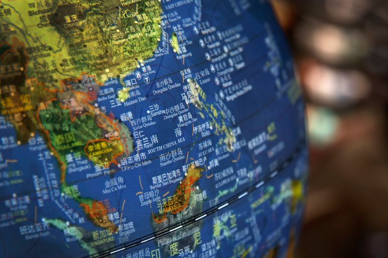
Malaysia rejects new China map claiming entire South China Sea
Government says ‘complex and sensitive’ dispute needs to be resolved through dialogue and urges swift agreement on code of conduct.

Malaysia has rejected the latest edition of the ‘standard map of China’ that lays claim to almost the entire South China Sea, including areas lying off the coast of Malaysian Borneo.
Tensions have been rising in the strategically important waters as China has become increasingly assertive in its claim despite a 2016 international court ruling that its so-called ‘nine-dash line’ was without merit and superseded by the 1982 United Nations Convention on the Law of the Sea (UNCLOS).
Keep reading
list of 4 itemsPhilippines supplies grounded South China Sea ship despite China threats
China military drills send ‘stern warning’ to Taiwan after US visit
What’s behind rising China-Philippines tensions in the South China Sea?
In recent years, it has built military outposts on rocky outcrops and deployed its coast guard and maritime militia, which has sometimes led to confrontations with other claimants, including Malaysia and the Philippines. Vietnam, Brunei and Taiwan also have claims to the sea.
Malaysia noted the new map, which clearly depicts the nine-dash line, showed China’s “unilateral maritime claims” and that they overlapped with Malaysia’s claims of its states of Sabah and Sarawak.
“Malaysia does not recognise China’s claims in the South China Sea as outlined in the ‘2023 edition of the standard map of China’ which extends into Malaysian maritime area,” the foreign ministry said in a statement on Thursday night. “The map has no binding effect on Malaysia.”
The tongue-shaped nine-dash line is based on Chinese historical records dating to the Xia dynasty, nearly 4,000 years ago.
India has already lodged a strong protest over China’s new map, which it said showed the Indian state of Arunachal Pradesh and the Aksai Chin plateau as official Chinese territory. The two have been in dispute over their mutual border for decades with clashes reported as recently as 2020.
“We reject these claims as they have no basis. Such steps by the Chinese side only complicate the resolution of the boundary question,” India’s foreign ministry spokesman Arindam Bagchi said in a statement.
Asked about India’s criticisms, Beijing said the map reflected China’s “exercise of sovereignty in accordance with the law”.
“We hope relevant sides can stay objective and calm, and refrain from over-interpreting the issue,” foreign ministry spokesman Wang Wenbin told the media at a briefing on Wednesday.
In its statement, Malaysia said the issue of South China Sea sovereignty was “complex and sensitive” and needed to be resolved through dialogue and consultation in accordance with international law, including UNCLOS.
It said it was committed to further negotiations for an “effective and substantive” code of conduct in the South China Sea leading to its “expeditious” conclusion.
Malaysia has said it will continue exploring for oil and gas off Borneo despite Chinese threats. In 2021, it summoned the Chinese ambassador to protest against the “presence and activities” of Chinese vessels in its exclusive economic zone (EEZ) off Borneo.
China has also caused upset in the Philippines with its activities in the South China Sea.
A number of incidents have been reported around Second Thomas Shoal, known as Ayungin Shoal in the Philippines, which lies about 200km (124 miles) from the Philippine island of Palawan and more than 1,000km (621 miles) from Hainan Island, China’s nearest major landmass.
Earlier this month, Manila summoned the Chinese ambassador after the Chinese coast guard fired a water cannon at a ship trying to resupply Filipino sailors there, while in February, it lodged a protest after accusing China of directing a “military-grade laser” at its vessels.
Beijing took control of Scarborough Shoal from the Philippines after a months-long standoff in 2012, having taken Mischief Reef in 1995. It seized the Paracel Islands from Vietnam in 1974.